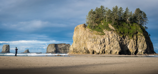
Brothers on Mother Mountain
Mt. Rainier National Park – Mother Mountain Loop

- Elevation gain: 4122 ft
- 22.1 miles
- Loop trail
- GPS file here
Being new to the Pacific Northwest I had a preconceived idea of what the area would look like, lush greenery with large ferns, moss coating everything and giant trees, and it certainly lived up to that and much more. In the 20 miles we encountered rainforest, old growth forest, alpine, snow fields, and meadows filled with delicious and bear attracting blueberries
When planning an overnight hike in a national park always have back up itineraries. Friday morning before the hike I booked it to the Carbon River Ranger station and arrived at 7:20 am, 10 minutes before opening, and there was already a line of 5 eager hikers. Permits for some areas are extremely tough to acquire so be sure to have backup hikes/alternative camp sites you wouldn’t mind staying at.
My brothers, Blake and Zack, flew in from North Carolina and Iowa late Friday night pumped to hit the trail in the morning.

Brothers pic
The way our itinerary worked out, we would start at Mowich Lake and have a 10 mile hike to Cataract Valley campground on day 1, 5 miles to Eagle’s Roost campground on day 2, and a short 2 mile hike out on day 3.
The trailhead starts off around 5,000 ft and quickly drops to half that as you walk down into the valley between Castle and Gove Peak. You’ll zig and zag on a series of switchbacks in a tree free area offering great views before entering the forest and following alongside Ipsut Creek. Walking through old growth forests among giant Hemlocks, Douglas Firs, Cedars, etc that can be upwards of 1000 years is a humbling feeling that makes you really appreciate the national park system and their devotion to preserving the natural world.

Trekking through the fog
Along Carbon river a section of the trail has been closed down so we got to do some river crossings as a detour. Sections of the trail can be tricky to spot here so be on the lookout for cairns to help guide the way, but thanks to the detour, we had the opportunity to walk across the 200 ft Carbon River Suspension Bridge, which would be worth doing even if the detour wasn’t in place. From here it was just a leisurely 1200 ft climb to Cataract Valley campsite.

Carbon River Suspension Bridge
When the sun drops, so does the temperature. We were all bundled up in gloves and hats, base and mid layers as well as rain jackets to help keep in all the body heat possible and still ready to crawl into our sleeping bags once the hot meals were polished off.
Day 2
The day started off dry and fairly clear which always makes for a nice morning. After breaking down camp, munching on some eggs in a bag, and enjoying some delicious french pressed Seattle roasted coffee, we were ready for the awesome day ahead. For the better part of the first half of the day we climbed. Passing through Seattle Park we spotted a couple of deer along the trail that kept us entertained for a good 15 minutes. We pressed on taking a break for lunch about 1000 ft below Flett Glacier. For about 20 minutes while making lunch we were sitting inside a cloud with no idea of our surroundings until all of a sudden the cloud briefly broke and gave us an awesome view of the mountain across the valley.
After lunch we had a little energy to burn so we literally jumped head first at the opportunity to do some glacading on a snowfield.

Glacading down the mountain!
We climbed on and eventually reached our highest elevation of over 6,300 ft just before entering Spray Park. On a clear day Spray Park offers incredible views reaching to the North Cascades in one direction and in the other Mt. Rainier towers overhead as you are at the base of the volcano.

View from Spray Park on a clear day
The alpine meadows of Spray Park are bursting with blueberries so stop and taste the fruit if the bears don’t beat you to it. We carried on and as we passed over a little ridge a bear was just sauntering across the trail about 75 yards out. He was a large brown colored bear that appeared to have the shoulder hump of a Brown Bear, but he was too far out to positively identify.

Crossed paths with this guy!
We gave him space and slowly continued past where he crossed while making noise to let him know we were there. The last thing we wanted to do was spook a bear, especially since the fog was getting thicker. The dense fog and bears in the area were making us a little weary, but it gave it a mystical and eerie feel.

On guard for bears creeping through the fog
Further along the trail we came to Spray Falls pull off. We followed the side trail and could hear the growing roar but when we came to the end of the trail at Spray Creek, we were left with a disappointing view. If you’re comfortable with creek crossings it’s definitely worth it to see the 300 ft waterfall in all its glory.

Zack under Spray Falls
Day 3
We got an early start in hopes of seeing Rainier and we weren’t disappointed by the Eagle Cliff lookout.

Mt. Rainier from Eagle Cliff
Had we known the lookout was so close to Eagles Roost campground we would have made the short hike to the lookout the previous night to watch the sunset, which we recommend doing.
The remainder of the hike out to Mowich lake was pretty short and uneventful, but the hike around the lake itself back to the car was a nice way to cap off the trip.
Tips
- The road (SR 165) taking you to the trailhead is gravel and dirt with potholes that will swallow a small car. It’s only open from July to October and may close during that time, so check ahead on the road status.
- Be prepared for the temperature to drop at night, bring layers
- Get to the ranger station early to get permits, and come with backup itineraries